
Demographers and Society
Demographers and Society
General Israel - Small in Size, Huge in Landscape
General Israel - Small in Size, Huge in Landscape
Nov 17, 2025
ISRAEL: A Small Dot on the Map, a Whole World Within (Written by the Israel Digital Center. Date of writing: 11/10/25)
Between the river and the sea lies a democratic and dynamic nation.
A tiny spot on the map, yet a world of possibilities. Israel, covering only 27,000 square kilometers, smaller than the U.S. state of Massachusetts and just 0.4% of the Middle East, still manages to be a country larger than life.
Its strategic location at the crossroads of Asia, Europe, and Africa has made it a meeting point of cultures, trade, and civilizations throughout history. Within its borders, Israel offers a stunning variety of landscapes, climates, cultures, and thousands of years of history.
Borders of the Country
Israel is surrounded by its Arab neighbors: Lebanon to the north, Syria to the northeast, Jordan to the east, and Egypt and the Gaza Strip to the southwest. To the west lies a beautiful Mediterranean coastline lined with major ports and scenic beaches. At the southern tip, on the Red Sea, sits Eilat - Israel’s southern gateway to the world.
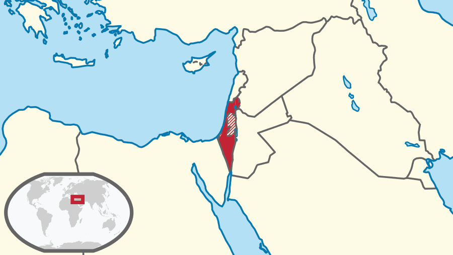
The country stretches from the Jordan River in the east to the Mediterranean Sea in the west, crossing mountains, deserts, bustling cities, and unforgettable landscapes.
Changing Landscapes
Israel’s unique location gives it an extraordinary range of landscapes: from the mountains of the Galilee, the Golan Heights, and snowy Mount Hermon in the north, through the fertile coastal plain in the center, to the vast deserts of the Negev and the Arava in the south. Along its eastern border lies the Dead Sea — the lowest point on Earth.
A short two-hour drive in any direction reveals new scenery, different climates, and changing colors - a small country containing an entire world. This diversity is reflected not only in nature but also in its people and cities.
Despite its size, Israel is a global leader in nature conservation, reforestation, and desert restoration. In recent years, large-scale projects have connected science, environment, and technology — from water-saving innovations to renewable energy in the desert.
Israel’s Major Cities
Just like its landscapes, Israel’s cities reflect its cultural and religious diversity.
Jerusalem, the capital, is sacred to the three major monotheistic religions - Judaism, Christianity, and Islam and combines ancient history with modern life. Tel Aviv, on the other hand, represents Israel’s modern face: a global city leading in technology, culture, and openness, also known as one of the most LGBTQ-friendly cities in the world.
The contrast between the two, separated by only a 40-minute drive, is unlike anywhere else. the perfect expression of Israeli identity. Across the country, cities reflect a rich human mosaic of Jewish, religious, and Arab communities, each with its own character.
Israel is also known as the “Startup Nation,” home to hundreds of international tech companies. It combines scientific innovation with human creativity from groundbreaking research labs to a vibrant cultural scene. The blend of ancient heritage and cutting-edge technology, of history and futurism, is at the heart of what makes Israel unique.
“From the River to the Sea”?
Understanding Israel’s geography makes it easier to understand the slogan “From the river to the sea.” It simply describes the land between the Jordan River in the east and the Mediterranean Sea in the west.
In today’s world, however, this slogan has taken on a political meaning - used by some as a call to erase Israel from the map. But they likely overlook what truly lies between those two points: a democratic, vibrant, and innovative country that guarantees freedom of religion and culture for all its citizens.
With everything Israel has built, from research and innovation to shared life in its mixed cities, it’s no wonder some want it all for themselves. Who wouldn’t?
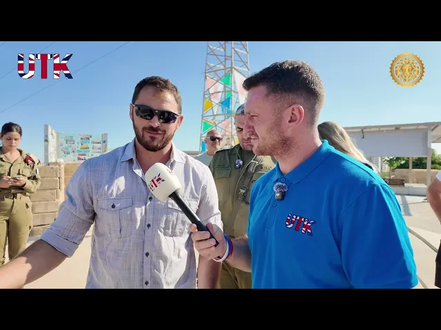
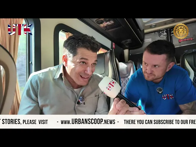
A former paratrooper and reserve commander takes us from the frontlines to the world stage — describing life in Sderot, fighting inside Gaza (Machon Al-Quds, Nuseirat, Beit Hanoun) and the trauma of October 7. He explains how close Gaza is to Israeli towns, recalls the 2005 Gush Katif withdrawal, and shares raw, personal scenes from months spent in active combat — then returning home to face a different battle: the rise of antisemitism worldwide. What you’ll hear in this video: • A frontline commander’s personal testimony about October 7 and the months that followed. • Firsthand descriptions of operations in Gaza (Nuseirat, Beit Hanoun) and daily threats from tunnels and armed militants. • Reflections on the 2005 Gaza withdrawal (Gush Katif) and what it meant for local communities. • The psychological shift from military duty back to civilian life and confronting global antisemitism.
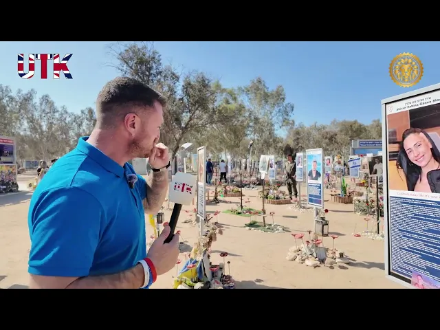
Tommy Robinson visits Re’im, the site of the Nova Festival massacre, during the two-year memorial of the October 7th atrocities. Hear the harrowing first-hand testimonies of survivors and witnesses as they recount what truly happened when Hamas terrorists attacked innocent festivalgoers. This is the raw, unfiltered truth of that dark day, as told by those who lived through it.

After watching previously unseen footage showing the massacre of 110 innocent people by Hamas on October 7th, Tommy Robinson shares his raw reaction and reflections. He speaks about what he witnessed, the mindset behind the attacks, and how the reality on the ground in Israel differs from what much of the media shows. This is not easy to watch — but it’s an honest account of what he saw and why he believes the world needs to understand the true nature of this conflict.

Today I visited the Kibbutz closest to the Gaza border. Where some 5,000 Hamas jihadist scum launched their attack on Israeli citizens on October 7th. I speak to this brave gentleman, Thomas Hand, whose 8 year old daughter was kidnapped by the terror group that day. Listen to the harrowing testimony of a father, one story, amongst thousands. Thank you for sharing your experience Thomas. This video is not for the feint of heart.
In this explosive interview, Amichai Chikli Minister of Diaspora Affairs of Israel delivers a powerful warning about the rise of radical Islam and the Muslim Brotherhood’s dangerous global ambitions, from establishing a Caliphate to imposing Sharia law across Europe and beyond. He slams the UK’s Labour government under Keir Starmer for its "fear-driven" approach to extremism, drawing chilling parallels to appeasement tactics before WWII. Discover why he believes Britain must act decisively to avoid a catastrophic wake-up call. Join the conversation on this critical fight for freedom and democracy!
A former paratrooper and reserve commander takes us from the frontlines to the world stage — describing life in Sderot, fighting inside Gaza (Machon Al-Quds, Nuseirat, Beit Hanoun) and the trauma of October 7. He explains how close Gaza is to Israeli towns, recalls the 2005 Gush Katif withdrawal, and shares raw, personal scenes from months spent in active combat — then returning home to face a different battle: the rise of antisemitism worldwide. What you’ll hear in this video: • A frontline commander’s personal testimony about October 7 and the months that followed. • Firsthand descriptions of operations in Gaza (Nuseirat, Beit Hanoun) and daily threats from tunnels and armed militants. • Reflections on the 2005 Gaza withdrawal (Gush Katif) and what it meant for local communities. • The psychological shift from military duty back to civilian life and confronting global antisemitism.
Tommy Robinson visits Re’im, the site of the Nova Festival massacre, during the two-year memorial of the October 7th atrocities. Hear the harrowing first-hand testimonies of survivors and witnesses as they recount what truly happened when Hamas terrorists attacked innocent festivalgoers. This is the raw, unfiltered truth of that dark day, as told by those who lived through it.
After watching previously unseen footage showing the massacre of 110 innocent people by Hamas on October 7th, Tommy Robinson shares his raw reaction and reflections. He speaks about what he witnessed, the mindset behind the attacks, and how the reality on the ground in Israel differs from what much of the media shows. This is not easy to watch — but it’s an honest account of what he saw and why he believes the world needs to understand the true nature of this conflict.
Today I visited the Kibbutz closest to the Gaza border. Where some 5,000 Hamas jihadist scum launched their attack on Israeli citizens on October 7th. I speak to this brave gentleman, Thomas Hand, whose 8 year old daughter was kidnapped by the terror group that day. Listen to the harrowing testimony of a father, one story, amongst thousands. Thank you for sharing your experience Thomas. This video is not for the feint of heart.
In this explosive interview, Amichai Chikli Minister of Diaspora Affairs of Israel delivers a powerful warning about the rise of radical Islam and the Muslim Brotherhood’s dangerous global ambitions, from establishing a Caliphate to imposing Sharia law across Europe and beyond. He slams the UK’s Labour government under Keir Starmer for its "fear-driven" approach to extremism, drawing chilling parallels to appeasement tactics before WWII. Discover why he believes Britain must act decisively to avoid a catastrophic wake-up call. Join the conversation on this critical fight for freedom and democracy!

Contact Us
Contact Us
Writers, other artists who are interested in taking part, we are here for any request, question, or idea

About us
Lorem ipsum dolor sit amet, consectetur adipiscing elit. Aliquam sodales orci nec quam fringilla, in viverra nisl viverra. Pellentesque quis erat dolor. In elementum egestas fringilla.
Lorem ipsum dolor sit amet, consectetur adipiscing elit. Aliquam sodales orci nec quam fringilla, in viverra nisl viverra. Pellentesque quis erat dolor. In elementum egestas fringilla.
All rights reserved to Israel Digital Center | Official Website 2025
All rights reserved to Israel Digital Center | Official Website 2025
ISRAEL DIGITAL CENTER


Follow us
About us
Lorem ipsum dolor sit amet, consectetur adipiscing elit. Aliquam sodales orci nec quam fringilla, in viverra nisl viverra. Pellentesque quis erat dolor. In elementum egestas fringilla.
All rights reserved to Israel Digital Center
| Official Website 2025